

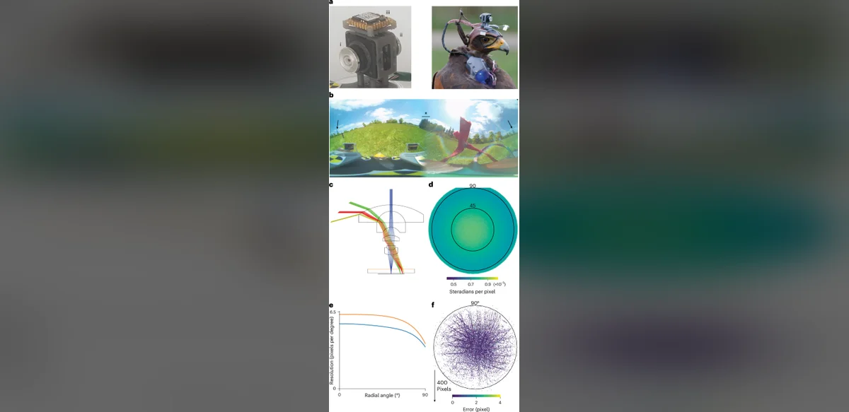
Researchers have developed a novel approach that pairs a compact head-mounted camera with drone-assisted environmental mapping. This combination enables precise reconstruction of flight trajectories and specific actions, including prey capture, in birds that fly freely outdoors. The method focuses on species such as the Harris’s hawk and provides scientists with detailed data previously difficult to obtain in natural settings.
The system works by attaching a lightweight camera directly to the bird’s head. At the same time, drones survey and create detailed maps of the surrounding area. Together these tools generate accurate three-dimensional records of movement and behavior. Scientists can then analyze the footage and mapping data to understand how birds navigate, hunt, and interact with their environment.
Traditional observation techniques often fall short when studying fast-moving animals in open spaces. Ground-based cameras or stationary sensors frequently miss critical moments or lack the spatial context needed for full analysis. The new integrated setup overcomes many of these limitations by delivering synchronized visual and positional information.
Field tests have shown that the technology can capture sequences of prey capture with high clarity. By correlating the bird’s head movements with the drone-generated terrain model, researchers reconstruct the exact path taken during each flight segment. This level of detail supports studies of hunting strategies and sensory processing in avian species.
The approach is designed to minimize interference with the animal’s natural activity. The head-mounted unit is small and lightweight, allowing the bird to fly and behave normally. Drone operations are conducted at a distance that avoids disturbance while still collecting necessary mapping information.
Applications extend beyond basic research. Conservation biologists may use the reconstructed data to assess how habitat changes affect flight patterns and foraging success. Wildlife managers could apply similar techniques to monitor populations of birds of prey in changing landscapes.
Further development could refine camera resolution and mapping precision. Improved sensors might allow longer recording sessions and more complex behavioral analysis. Integration with additional tracking technologies could expand the range of species and environments studied.
The method represents an advance in ethology and biomechanics. It demonstrates how combining wearable devices with aerial mapping can yield comprehensive insights into animal locomotion and decision-making in the wild. Continued refinement is expected to broaden its utility across multiple scientific disciplines.
Overall, the head-mounted camera and drone mapping technique offers a practical solution for detailed outdoor behavioral studies. It addresses longstanding challenges in tracking free-flying birds and supplies researchers with reliable data for understanding natural actions such as prey capture. The approach is likely to influence future investigations into avian ecology and movement science.