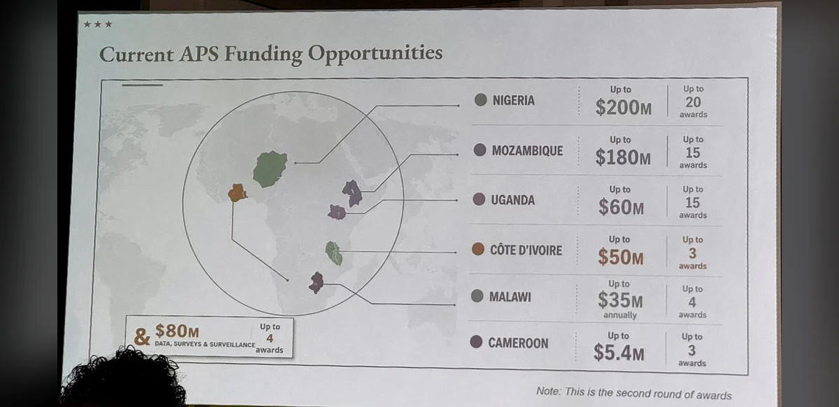
The recent presentation delivered by US government officials featured a map of the African continent that contained multiple errors in country placement and boundaries. Attendees observed that the visual representation deviated significantly from established geographic standards. The slide in question formed part of a broader set of materials used to illustrate regional topics during the session.
Upon closer inspection the map displayed an artificial intelligence watermark confirming its creation through OpenAI tools. This marking appeared in a corner of the image and indicated the use of generative technology in producing the visual aid. Officials did not comment on the process behind the map’s development at the time of the presentation.
The inclusion of such a map raised questions about verification procedures for visual materials in official briefings. Standard practice typically involves cross checking geographic data against reliable sources prior to public display. In this instance the errors encompassed incorrect positioning of nearly all nations on the continent.
Discussions following the event highlighted the growing role of artificial intelligence in content generation across government agencies. While these tools offer efficiency benefits they also require careful oversight to maintain accuracy. The watermark served as a clear indicator of the technology employed in this particular case.
Geographic accuracy remains essential in diplomatic and policy contexts where maps inform decision making. Errors in representation can lead to misunderstandings about regional dynamics and borders. The presented map failed to align with internationally recognized cartographic references.
The incident prompted internal reviews of how visual aids are prepared and approved. Agencies are expected to implement additional checks when incorporating AI generated elements into formal documents. Such measures aim to preserve the integrity of information shared in professional settings.
Public reaction to the map focused on the evident discrepancies rather than the method of creation. Analysts noted that the combination of factual errors and AI origin underscored challenges in balancing innovation with precision. The event has since been referenced in broader conversations about technology adoption in public service.
Further details about the specific presentation context were not released. The focus remained on the map itself and the visible watermark that confirmed its digital origin. This single element provided the primary clue regarding the production method.
Overall the episode illustrates the need for rigorous quality control in materials used by government bodies. Maps serve as foundational tools for communication and any deviation from accuracy can affect perceptions of the subject matter. The use of AI in this instance was transparent due to the watermark yet the resulting product did not meet expected standards.
Continued attention to these issues may lead to updated guidelines for content creation. Agencies continue to explore technological solutions while emphasizing the importance of human review. The map in question stands as an example of both the capabilities and limitations encountered in current practices.